
August 25, 2014
After camping on top of Reinebringen, I was excited for our next night, heading up over a ridge to camp at Kvalvika Beach for the second night. Parking on the inside of the fjord, we left the car and hiked 1-1.5 hours up over the ridge and back down to the expansive golden beach below. Kvalvika is a beautiful beach backed by grassy ridges with a bit of an end of the world type vibe. The massive peaks all around the beach lend to its isolated feeling, backed by large boulders and the occasional sheep wandering the paths. While there were probably 5 or 10 other people camping on the beach that night, it was large enough to spread out and have an entire area to yourself, so it was perfect for us.
Despite being tired, I convinced myself that I needed to climb Ryten, the adjacent 1,100 foot mountain, and I was glad I did. Climbing up the steep slopes around 7 pm, I first discovered a high mountain lake that feeds the small cascade down the hillside, and then followed the ridge up to the top of Ryten for spectacular views down to the beaches below and out to the vast Norwegian Sea. As the cool wind blew in, the sun dipped low behind the clouds, creating an unbelievable view as the deep orange reflected off the endless water below. Though I was tired, I couldn't believe the beautiful scene unfolding in every direction around me. As I sat on the edge of the cliff, I took in the expansive views before heading back down to the beach to find my tent and get some rest.
In the morning, we tried to hike around a series of huge boulders to get to the second beach, but the rocks were extremely slippery, so we decided to be safe/smart and instead packed up and headed out in the late morning.




After camping on top of Reinebringen, I was excited for our next night, heading up over a ridge to camp at Kvalvika Beach for the second night. Parking on the inside of the fjord, we left the car and hiked 1-1.5 hours up over the ridge and back down to the expansive golden beach below. Kvalvika is a beautiful beach backed by grassy ridges with a bit of an end of the world type vibe. The massive peaks all around the beach lend to its isolated feeling, backed by large boulders and the occasional sheep wandering the paths. While there were probably 5 or 10 other people camping on the beach that night, it was large enough to spread out and have an entire area to yourself, so it was perfect for us.
Despite being tired, I convinced myself that I needed to climb Ryten, the adjacent 1,100 foot mountain, and I was glad I did. Climbing up the steep slopes around 7 pm, I first discovered a high mountain lake that feeds the small cascade down the hillside, and then followed the ridge up to the top of Ryten for spectacular views down to the beaches below and out to the vast Norwegian Sea. As the cool wind blew in, the sun dipped low behind the clouds, creating an unbelievable view as the deep orange reflected off the endless water below. Though I was tired, I couldn't believe the beautiful scene unfolding in every direction around me. As I sat on the edge of the cliff, I took in the expansive views before heading back down to the beach to find my tent and get some rest.
In the morning, we tried to hike around a series of huge boulders to get to the second beach, but the rocks were extremely slippery, so we decided to be safe/smart and instead packed up and headed out in the late morning.

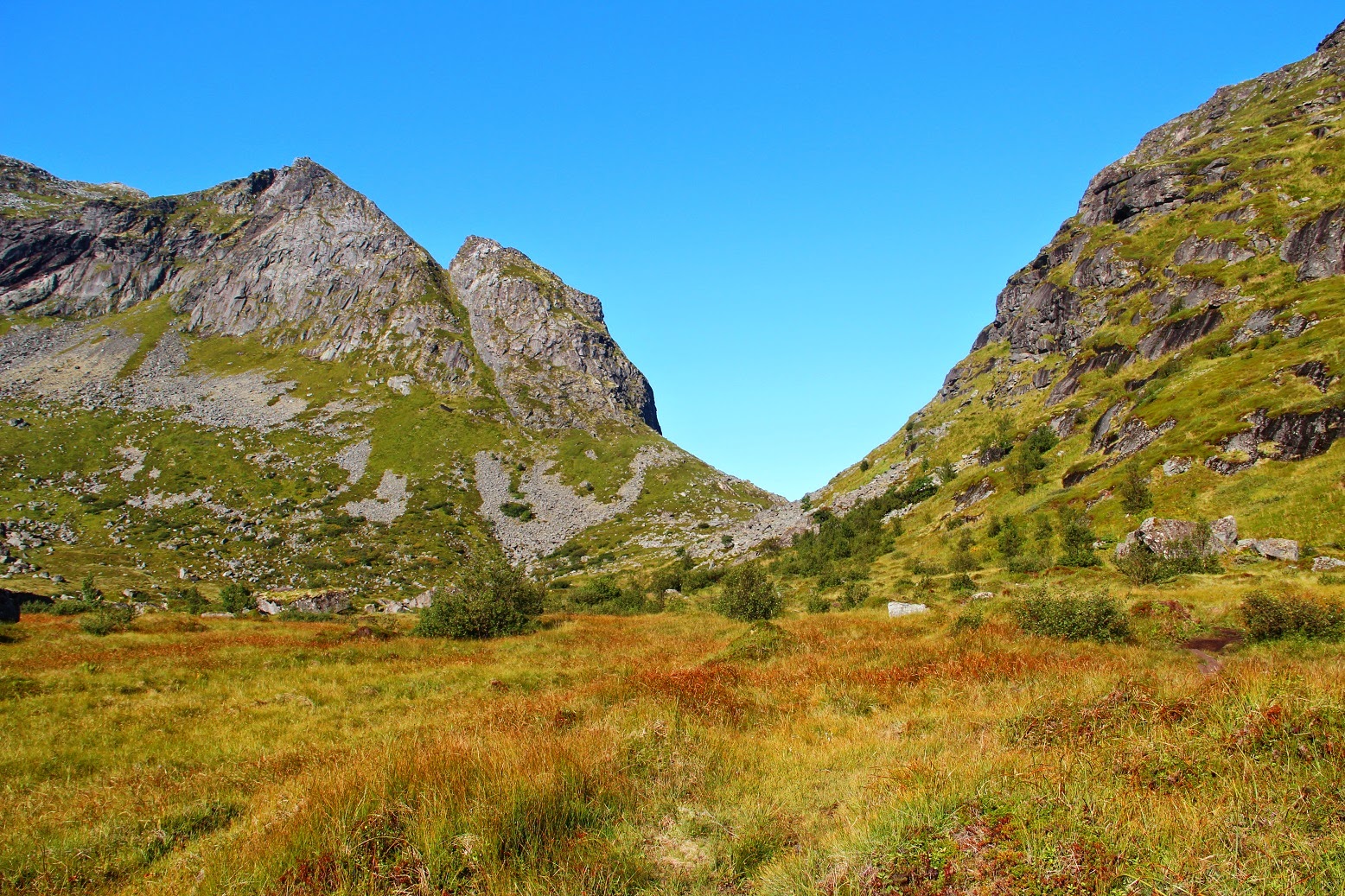
(Craig hiking along the boards that help get through some of the sludge along the trail as it passes through some boggy areas. We hiked up to the saddle in the middle of the ridge and then steeply down to the beach below.)
(Craig can be seen in the bottom of this picture, hiking down to the beach below as we scouted out our camp site for the evening.)
(Craig and his tent, with the 1,100 foot mountian, Ryten, in the background. I climbed to the top of that ridge later that evening, in spite of deciding against it earlier on the hike to the beach, mostly because I was tired/lazy.)
(Craig goes for a quick wade in the water. As inviting as it looks, the water is absolutely freezing, which makes sense. At 68 degrees North, this is as far North as parts of the Antarctic Peninsula are South.)
(Climbing up Ryten, I stopped for a view of Craig strolling the vast beach below.)
(The hidden lake halfway up to Ryten, high above the beach just below the edge of this picture.)
(We camped on the first beach in the picture, and a large series of boulders blocks most from getting to the second beach.)
(While enjoying the view atop Ryten, the sun fell behind this long cloud for a spectacular sunset. Though I was tired and didn't want to make the steep climb, I was definitely happy that I made myself do it.)
(Another view of Kvalvika Beach from Ryten.)
(A panorama from the top of the mountain. The climb up from the beach was about 1.5 hours and about 1 hour to make it back down.)
(My campsite the following morning.)
(The morning light illuminates Kvalvika Beach.)
(One last view of Kvalvika before heading back over the ridge the next morning.)
(Hiking back from the beach towards our car.)
(Craig heading back along the boards to our car at the water level in the bottom right of the picture.)
(Fog began to pour into the fjord as we got back to the car and headed up the coast to check out more of the beautiful scenery.)


 (After leaving the bumpy gravel and dirt road, I followed a tiny footpath down to the beach on my motorcycle, stopping at a house or two on the way to ask for directions.)

 (Getting out of El Nido, you quickly get back into the rural parts of Palawan with tiny farmers' huts along the side of the road.)
 (Maremegmeg Beach - from Corong-Corong, about 3 km South of El Nido, this beach is a 30-45 minute walk further South, but it's definitely worth it.)


